About University
About University
Cradled in the lap of mountains at the foothills of auspicious Trikuta, besides the river Tawi at an altitude of 1030 ft. is Jammu. This 'city of temples' has many places...
Cradled in the lap of mountains at the foothills of auspicious Trikuta, besides the river Tawi at an altitude of 1030 ft. is Jammu. This 'city of temples' has many places...


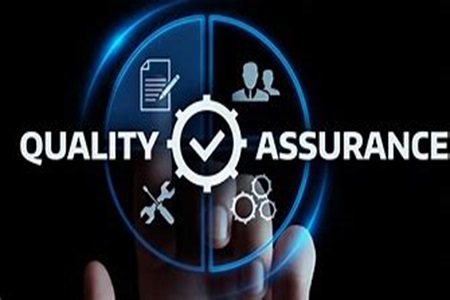
One of the emerging challenges faced by any higher educational institution is the development, application and maintenance of quality...
Course Outcomes
Semester-1
1. Information Technology (P2RSTC101)
It enables students to learn the basic professional skills pertaining to Information Technology, such as hardware, software and data, coding- ASCII, UNICODE, DBMS, logical data model, physical and logical views, spatial databases available for natural resources and terrain, communication systems, communication types, major types of networks-LAN, WAN, MAN etc., topologies, internet, WWW, web server, client, web browser, TCP/IP Protocol Suite, IP Address, introduction to C, operators, conditional control statements, looping control statements, functions, pointers, single dimensional arrays, double dimensional arrays, strings, standard and library functions, structures & unions, and files
2. Fundamentals of Remote Sensing and Image Interpretation (P2RSTC102)
To become aware about the fundamental concept of Remote Sensing, EM Radiation and EM Spectrum, black body radiation, laws of radiation, interaction of EMR with atmosphere and earth’s surface, platforms- aerial and space borne characteristics, satellites and their characteristics, earth resources satellites, meteorological satellites, basic concept and principles of active and passive sensors, sensors types and their characteristics, optical imaging sensors, concept of resolution, steps and elements of image interpretation, multidate, multispectral and multiresolution concepts, instruments for visual interpretation, Remote Sensing data products, ground truth collection, commonly used ground truth equipments, display forms- computer printouts, thematic maps and dot density maps.
3. Aerial Photography, Aerial and Digital Photogrammetry (P2RSTC103)
It enables students to learn the basic professional skills pertaining to basic information, specifications, types and geometry of aerial photographs, planning and execution of photographic flights, aerial cameras, aerial film negative and its processing- completion of photographic task, making measurements from aerial photographs, measurement of height from aerial photographs, relief displacement of vertical features and its determination, vertical exaggeration and slopes, elements of photointerpretation, symbols and colour schemes used in photointerpretation, definition and terms in photogrammetry, theory of orientation relationship between image and corresponding ground coordinates, collinearlity and coplanarity of aerial photographs, aerial mosaics, scale of aerial photographs and its determination, stereovision and stereoscopes, stereoscopic exaggeration, concept of omega, phi and kappa, stereoscopic parallax and parallax equations, orthophotos and digital orthophotography, principles of stereo photogrammetry and digital photogrammetry, model deformation and rectification, triangulation, bundle core formation, DEM Orthophotogeneration, difference between DEM, DTM and DSM, terrain analysis and modelling, advances in terrain analysis and potential applications of DEM in natural resources management.
4. Cartography and Global Navigation Satellite System (P2RSTC104)
The content of the course helps to understand the basic concept of cartography, nature and scope of cartography, scale, reference and coordinate system, conventional mapping vs digital mapping, digital cartography, relation between digital cartography, RS & GIS, cartographic transformations and reasons for transforming cartographic data, study of different types of maps, survey of India national series maps, layout and numbering of topographical maps, thematic maps and base maps, basics of map creation -principles of drawing, base materials-instruments, cartographic design - map design principles, symbolization and layout, representation of natural and cultural features, relief representations, map digitization, map compilation, fair drawing, editing of maps, and map reproduction process, introduction to Global Navigation Satellite System (GNSS), GNSS system elements and signals, classification of GNSS receivers, GNSS measurements and accuracy of GNSS, GNSS field survey design, GNSS data processing and data correction, augmented and regional navigation system and emerging trends in GNSS
Semester-2
1. Applied Statistics (P2RSTC201)
This course deals with the statistical techniques which are utilized in the remote sensing subject, for example skewness, moments, kurtosis, matrix algebra, multiple and partial correlation, simple linear regression, sampling techniques, sample size determination, standard discrete distributions, normal distribution with applications of standard normal curve, exponential distribution, concept of sampling distribution and standard error, concept of hypothesis, Chi square test for goodness of fit and test of independence, concept of analysis of variance(ANOVA), ANOVA with one way and two-way classification, introduction to design of experiment, CRD and RBD, introduction to multivariate techniques like multiple regression and multiple correlation, MANOVA, PCA, discriminant analysis and factor analysis, and case studies on multivariate analysis through SPSS/Excel software.
2. Digital Image Processing (P2RSTC202)
It enables students to learn the basic professional skills pertaining to concept of digital image, digitization of photographic image, image visualization, digital image data formats, image data storage, image retrieval, statistics used in digital image processing, image rectification, radiometric correction, geometric correction, image enhancement techniques, multi-image manipulation, enhancement by using colours, intensity hue saturation, PCA, image fusion techniques, change detection techniques, supervised classification, unsupervised classification and advanced classification techniques.
3. Geographical Information Systems (P2RSTC203)
This course helps to understand the fundamental concept of Geographical Information Systems (GIS), computer fundamentals for GIS, hardware and software requirements for GIS, coordinate system and projections in GIS, data structure and formats, spatial data models, spatial data quality and uncertainty, data base design, editing and topology creation in GIS, linkage between spatial and non-spatial data, vector based spatial data analysis, raster based spatial data analysis, buffer analysis, network analysis, data quality and sources of errors, integration of RS and GIS data, digital elevation model and derivation of parameters, GIS data integration and modeling, open sources software and cloud computing, overview of spatial data infrastructure and decision support systems, recent trends in GIS -AM/FM, virtual 3d GIS, mobile GIS, OLAP, internet GIS, open GIS, GIS customization and GIS for citizen science.
4. Thermal, Microwave and LiDAR Remote Sensing (P2RSTC204)
This course deals with fundamentals of thermal, microwave and LIDAR remote sensing, for example, thermal radiation principles, thermal properties, characteristics of thermal IR images and factors affecting thermal images, interaction of thermal radiation with terrain elements, thermal image and types of available data products and interpretation, land surface temperature mapping with thermal scanner data, single channel and multichannel thermal data analysis, information extraction from thermal mapping, active and passive microwave remote sensing, interaction of passive microwave radiometers and surface materials- brightness temperature, dielectric constant, and polarization, interaction of radar and surface materials-complex dielectric properties, surface roughness polarization, side looking airborne radar (SLAR), synthetic aperture radar (SAR)-imaging modes, radar data calibration, geometric corrections and data interpretation, fundamentals of interferometry and polarimetry, radar altimetry, microwave remote sensing applications, physics of laser, laser interaction with objects, platform of laser scanning, LiDAR-components of LiDAR system, type of LiDAR and potential applications of LiDAR data.
5. Project Work in Geospatial Technology (P2RSRVC251)[Vocational course]
The dissertation or project work in Geospatial Technology is a crucial component of a vocational course, providing students with hands-on experience and practical application of theoretical knowledge. It allows students to engage in real-world problem-solving using tools such as Remote Sensing (RS), Geographic Information System (GIS), Global Positioning System (GPS), and related geospatial technologies. This component enhances critical thinking, technical proficiency, and project management skills by enabling students to work on issues such as land use planning, disaster management, environmental monitoring, urban development, agriculture, and natural resource management. Through guided research or field-based projects, students learn how to acquire, process, analyze, and interpret spatial data to derive meaningful insights and solutions.
Semester-3
1. Remote Sensing & GIS in Geosciences (P2RSTC301)
To become aware about the use of Remote Sensing & GIS technology and datasets in geology, geomorphology and resultant landforms. Study of spectral characteristics of rocks and minerals, drainage patterns, interpretation of folds, faults, fluvial, glacial, coastal, eolian, volcanic, karst landforms, structural and denudational landforms. Role of Remote Sensing in neo-tectonics and active tectonic, seismicity and geodynamics in NW Himalaya, mineral exploration, oil exploration, geological hazards mapping and disaster management.
2. Remote Sensing & GIS in Water Resources (P2RSTC302)
To focus on implementation of Remote Sensing & GIS technology in hydrological cycle, surface water, snow cover and glacier mapping, ground water exploration, drainage mapping and morphometric analysis. Significance of geological mapping of rocks and structures and their hydro geological properties in groundwater exploration, watershed management, soil erosion and runoff estimation, water harvesting structures and optimum site selection for rain water harvesting, snow and glacial runoff modeling, flood plain mapping and hydrological response to climate change and Land use/ land cover change
3. Remote Sensing & GIS in Agriculture Soil and Land Evaluation Studies (P2RSTC303)
This subject deals with the awareness of integrating Remote Sensing & GIS technology in crop identification, crop acreage estimation, crop inventory, crop condition and stress assessment, crop yield modeling, drought assessment and monitoring, land use / land cover, soil physical properties and classification, soil mapping, distribution of soil types in India, wasteland mapping and management, land degradation identification and mapping, mapping of salt affected soil, soil erosion and erosion hazard assessment, land use capability classification, land irrigability classification, irrigation infrastructure and command area mapping, soil moisture estimation and crop water requirement assessment and land evaluation for optimal land use planning
4. Remote Sensing & GIS in Forestry (P2RSTC304)
The students develop expertise in implementation of Remote Sensing & GIS technology and datasets in forest cover mapping, forest density monitoring, distribution of forests, forest cover change detection, mapping of stressed vegetation, biomass estimation, growing stock estimation, biodiversity studies, wildlife habitat analysis, biological invasion and monitoring of invasive species and forest management information system.
Semester-4
1. Remote Sensing & GIS in Urban Studies (P2RSTC401)
It renders societal concern and proactive measures for use of Remote Sensing & GIS in urban and regional planning, different methods for population estimation, urban sprawl and change detection studies, master plan monitoring and urban growth modeling.
2. Remote Sensing & GIS in Environmental Science (P2RSTC402)
It enables students to learn the application of Remote Sensing & GIS in ecological and biological aspects of environment, water quality monitoring, environmental pollution, solid waste management, wastewater management, man-made and natural disasters, forest fire risk assessment, environmental impact assessment and environmental management plan.
3. Cryospheric Systems and Climate Change Science (P2RSTE403)
This course equips students with a comprehensive understanding of the cryosphere and its interactions with the global climate system. Learners will explore the elements, formation, and classification of glaciers, including dry and wet-based types, and gain insight into glacier dynamics, sediment transport, and the physics of glacier ice and snow. They will study glacial erosional and depositional features using remote sensing and GIS, and analyze glacier drainage characteristics and the dating of glacial landforms through space-based methods. The course delves into the origin of ice ages, including significant periods such as the Last Glacial Maximum and Little Ice Age, along with the instrumentation and techniques used in glaciological research. Students will evaluate meltwater discharge, its chemistry, and the limitations of various dating methods for glaciogenic deposits. The curriculum also covers the influence of meteorological parameters and aerosols on glaciers, energy and mass balance studies, glacier snout monitoring, and isotope-based assessments of climate change. Additionally, the course examines permafrost characteristics, associated mass movements, and mitigation strategies. Students will apply geospatial techniques to model snow and glacial runoff, study glacier lakes, assess hazards from Glacier Lake Outburst Floods (GLOFs), and understand the impact of black carbon on glacier melting and climate change. Finally, the course provides a deep understanding of global climate systems, including carbon cycling across physical, biological, marine, and terrestrial domains; the El Niño-Southern Oscillation and its climatic effects; global ocean circulation patterns such as the Gulf Stream and Atlantic Conveyor; and global wind systems, with particular focus on the Indian Summer and Winter Monsoons.
4. Disaster, Risk Reduction and Hazard Assessment (P2RSTE404)
This course provides a holistic understanding of natural and anthropogenic disasters, emphasizing the ability to differentiate between hazards, disasters, risk, and vulnerability while assessing disaster vulnerability across different groups and locations. Students will explore preparedness and mitigation strategies, disaster effects, and management approaches. The role of satellite remote sensing and GIS in real-time and post-disaster assessment—such as inundation, earthquakes, floods, crop loss, and forest fire risk—is thoroughly examined. The course integrates the use of GPS for early warning systems, GIS for risk analysis, and recent advancements in Geoinformatics for disaster management, including seismic microzonation using geological, geophysical, and GNSS data. Students will analyze heatwaves, cold waves, and droughts in spatial and temporal contexts, and study avalanche formation, classification, and mitigation using geospatial tools. Additionally, the course covers earthquake hazards, measurement techniques, flood zonation, landslide classification and management, and the study of Glacier Lake Outburst Floods (GLOFs) and avalanches through geospatial technologies, preparing students to assess, manage, and mitigate various disaster risks using modern scientific and technological approaches.
5. Project Work (P2RSRC405)
Implementing the knowledge of Remote Sensing & GIS in various fields such as, forestry, agriculture, water resources, snow/glaciers, geology, geomorphology, environmental science, pollution monitoring, water quality monitoring, urban sprawl, urban planning, disaster management and planning.
| Name | Designation | Qualification | Specialization | Contact Info. |
|---|---|---|---|---|
| Prof. A.S. Jasrotia | Professor & Head | M.Sc., M.Phil, Ph.D & P.G. Diploma in Remote Sensing & GIS | Remote Sensing & GIS | E-mail: asjasrotia@yahoo.co.ukEPABX: Mobile No.: 9419133793 |
| Dr. Ajay Kumar Taloor | Assistant Professor | M.Sc., Ph.D & P.G. Diploma in Remote Sensing & GIS | Remote Sensing & GIS | E-mail: ajaytaloor@gmail.comEPABX: Mobile No.: 9419116573 |