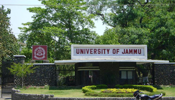
About University

Cradled in the lap of mountains at the foothills of auspicious Trikuta, besides the river Tawi at an altitude of 1030 ft. is Jammu. This 'city of temples' has many places...
PSO 1: Proficiency in Remote Sensing Technology
Students will have a deep understanding of remote sensing principles, techniques, and technologies. They will be proficient in acquiring, processing, and interpreting remote sensing data from various platforms, including satellite, airborne, and ground-based systems.
PSO 2: GIS Analysis and Application
Students will be skilled in using GIS software and tools for spatial data analysis, mapping, and visualization. They will be able to apply GIS techniques to solve real-world problems in various domains such as urban planning, environmental management, disaster management, and resource management.
PSO 3: Data Integration and Management
Students will be capable of integrating remote sensing data with other geospatial and non-geospatial data. They will understand data management practices, including data quality assessment, metadata creation, and the use of spatial databases.
PSO 4: Application Development and Customization
Students will be able to develop and customize GIS applications and tools to meet specific user needs. They will be familiar with programming languages and scripting tools relevant to GIS, such as Python, R, and JavaScript.
PSO 5: Problem Solving and Decision Making
Students will possess strong analytical and critical thinking skills, enabling them to design and implement effective solutions to complex spatial problems. They will be adept at using remote sensing and GIS to support decision-making processes.
PSO 6: Research and Innovation
Students will be prepared to conduct research and contribute to advancements in the fields of remote sensing and GIS. They will be capable of designing and executing research projects, publishing their findings, and staying updated with the latest technological developments.
PSO 7: Ethical and Professional Practices
Students will understand the ethical, legal, and professional issues related to the use of remote sensing and GIS technologies. They will be committed to responsible use of spatial data and technologies, considering the societal and environmental impacts.
PSO 8: Communication and Teamwork
Students will have strong communication skills, enabling them to effectively present their findings and collaborate with multidisciplinary teams. They will be able to communicate technical information to both technical and non-technical audiences.
| Name | Designation | Qualification | Specialization | Contact Info. |
|---|---|---|---|---|
| Prof. A.S. Jasrotia | Professor & Head | M.Sc., M.Phil, Ph.D & P.G. Diploma in Remote Sensing & GIS | Remote Sensing & GIS | E-mail: asjasrotia@yahoo.co.ukEPABX: Mobile No.: 9419133793 |
| Dr. Ajay Kumar Taloor | Assistant Professor | M.Sc., Ph.D & P.G. Diploma in Remote Sensing & GIS | Remote Sensing & GIS | E-mail: ajaytaloor@gmail.comEPABX: Mobile No.: 9419116573 |