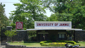
About University

Cradled in the lap of mountains at the foothills of auspicious Trikuta, besides the river Tawi at an altitude of 1030 ft. is Jammu. This 'city of temples' has many places...
Programs of Study: MSc (Remote Sensing and GIS )
|
Duration |
2 years / 4 semesters |
|
Intake capacity |
10 + 2 = 12 |
|
Self-Financing Seats |
All seats are self-financed |
|
Eligibility criteria A candidate seeking admission to the programme must have passed/appeared in the final year of bachelor’s degree in any subject of Science as core subject / BCA/ Engineering/ Agriculture/ Forestry or bachelor’s degree in Arts with Geography as core subjects from any recognized Indian University with minimum 50% marks. OR have earned 50% of Credits in any subject of science as core subject/ BCA/ Engineering/ Agriculture/ Forestry or bachelor’s degree in arts with Geography as core subjects in UG program under NEP-2020. |
|
Programme Structure
|
Semester-I |
||
|
Course No. |
Title |
Credit |
|
P2RSTC101 |
Information Technology |
4 |
|
P2RSTC102 |
Fundamentals of Remote Sensing and Image Interpretation |
4 |
|
P2RSTC103 |
Aerial photography, Aerial and Digital Photogrammetry |
4 |
|
P2RSTC104 |
Cartography and Global Navigation Satellite System |
4 |
|
P2RSPC105 |
Information Technology, RS and Image Interpretation |
4 |
|
P2RSPC106 |
Photogrammetry, Cartography and GNSS |
4 |
|
Field work: GNSS Survey, Remote Sensing data with Field Verification |
||
|
Semester-II |
||
|
Course No. |
Title |
Credit |
|
P2RSTC201 |
Applied Statistics |
4 |
|
P2RSTC202 |
Digital Image Processing |
4 |
|
P2RSTC203 |
Geographical Information System |
4 |
|
P2RSTC204 |
Thermal, Microwave and LiDAR Remote Sensing |
4 |
|
P2RSPC205 |
Statistics and Digital Image Processing |
4 |
|
P2RSPC206 |
Geographical Information System and Microwave Remote Sensing |
4 |
|
P1RSRE207 |
Vocational course |
4 |
|
Semester-III |
||
|
Course No. |
Title |
Credit |
|
P2RSTC301 |
Remote Sensing and GIS in Geosciences |
4 |
|
P2RSTC302 |
Remote Sensing and GIS in Water Resources |
4 |
|
P2RSTC303 |
Remote Sensing and GIS in Agriculture Soil and Land Evaluation Studies |
4 |
|
P2RSTC304 |
Remote Sensing and GIS in Forestry |
4 |
|
P2RSPC305 |
Remote Sensing and GIS in Geosciences and Water Resources |
4 |
|
P2RSPC306 |
Remote Sensing and GIS in Agriculture Soil and Land Evaluation Studies and Forestry |
4 |
|
|
Field Work: Field Work for Ground Truth Verification |
|
|
Semester-IV |
||
|
Course No. |
Title |
Credit |
|
P2RSTE401 |
Remote Sensing and GIS in Urban Studies |
4 |
|
P2RSTE402 |
Remote Sensing and GIS in Environmental Sciences |
4 |
|
P2RSTE403 |
Cryospheric Systems and Climate Change Science |
4 |
|
P2RSTE404 |
Disaster, Risk Reduction and Hazard Assessment |
4 |
|
P2RSRC405 |
Project Dissertation Work |
16 |
Research Programme Offered
Ph. D in Remote Sensing and GIS
Remote Sensing and GIS application in Water Resources, Climate Change & Hydrology, Land use Change Scenario, Cryosphere, Quaternary Geomorphology, Desertification Vulnerability, Urban & Rural Planning and Environmental Impact
| Name | Designation | Qualification | Specialization | Contact Info. |
|---|---|---|---|---|
| Prof. A.S. Jasrotia | Professor & Head | M.Sc., M.Phil, Ph.D & P.G. Diploma in Remote Sensing & GIS | Remote Sensing & GIS | E-mail: asjasrotia@yahoo.co.ukEPABX: Mobile No.: 9419133793 |
| Dr. Ajay Kumar Taloor | Assistant Professor | M.Sc., Ph.D & P.G. Diploma in Remote Sensing & GIS | Remote Sensing & GIS | E-mail: ajaytaloor@gmail.comEPABX: Mobile No.: 9419116573 |