About University
About University
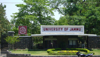
Cradled in the lap of mountains at the foothills of auspicious Trikuta, besides the river Tawi at an altitude of 1030 ft. is Jammu. This 'city of temples' has many places...
Cradled in the lap of mountains at the foothills of auspicious Trikuta, besides the river Tawi at an altitude of 1030 ft. is Jammu. This 'city of temples' has many places...


One of the emerging challenges faced by any higher educational institution is the development, application and maintenance of quality...
Hostel
The University of Jammu has three boys’ hostels and three girl’s hostels to meet the needs of students who seek hostel accommodation. Depending upon the availability of hostel seats, a limited number of candidates shall be accommodated in the hostel according to their merit which shall be determined by the University.
Library
The university has a Central Library with over 3 lakh titles and over 300 serial subscriptions. In the central Library EDUSAT facility through Consortium for Education Communication (CEC) is one of the nodes of UGC-sponsored information display by hub at IIRS Dehradun and Library Network (NFLIBNET) programme also. Besides that, the Remote Sensing and GIS Library has a rich collection of books and journals that can provide a window to look into the course details and its applications.
RSGIS Lab
The Remote Sensing and GIS lab. has been established with all the basic facilities required for Remote sensing and GIS work. The Remote Sensing and GIS lab. provides hands-on training to its postgraduate students in Digital Image processing, GIS, GPS, Satellite Navigation and Image Interpretation. This lab. is equipped with the server, workstation and Pentium IV computers with Global Positioning System (GPS), A0 Scanner, and Mirror Stereoscopes. The department has installed various latest GIS and Digital image processing software such as Arc GIS, ERDAS Imagine ERDAS Virtual GIS, ERDAS IMS, ILWIS 3.3 ROCK WORKS 2006, etc.
The department also conducts certificate programs in RS& GIS through EDUSAT which has been transmitted through the hub at IIRS, DOS Dehradun. The department is also engaged in various R&D projects funded by ISRO, DST, and NRSC such as Evaluation potential using Sensing and GIS Techniques in the Hill Terrain of Devak and Rui Watershed, Jammu District, J&K State funded by the Deptt. of Space, Govt. of India, Bangalore. Establishing the Natural Resources Digital Database District Centre at Jammu and Creation of an integrated database for Development Planning funded by the Ministry of Science and Technology, Department of Science and Technology, Govt. of India. Groundwater Prospect Mapping Work of Rajiv Gandhi Drinking Water Mission (RGNDWM) Phase III of J&K State” coordinated by National Remote Sensing Agency, Hyderabad funded by the Ministry of Rural Development.
The NRDMS, a multi-disciplinary programme of the Department of Science and Technology, Govt. of India aims at technological and institutional capacity building of the Line Departments in Spatial Technology-Remote Sensing and GIS operationalize the Decentralized Planning for economic development. The NRDMS DST District center Lab. has been generated maps in GIS environment on various aspects such as natural resources, socio-economic and various infrastructure facilities available at the village level in Jammu district. Such maps will go a long way in facilitating the concerned departments to undertake the micro-level planning more effectively to ensure balanced development of various blocks of the district. The spatial technology being promoted under this project has wider application in areas such as infrastructure planning.
The layout of University of Jammu has been also prepared in the GIS environment. In addition to that a lot of Research and Development (R&D) activities are going on in different Remote Sensing and GIS areas. The various maps of Jammu District have been prepared with the help of satellite image, toposheets and ground truth information. Information created under this helped various line departments of Jammu District for effective presentation of data like socio-economic, horticulture and agriculture data, etc. at village level, block level, constituency level or tehsil level. The aim of NRDMS DST center to train various line departments to access and update this data through GIS software.
| Name | Designation | Qualification | Specialization | Contact Info. |
|---|---|---|---|---|
| Prof. A.S. Jasrotia | Professor & Head | M.Sc., M.Phil, Ph.D & P.G. Diploma in Remote Sensing & GIS | Remote Sensing & GIS | E-mail: asjasrotia@yahoo.co.ukEPABX: Mobile No.: 9419133793 |
| Dr. Ajay Kumar Taloor | Assistant Professor | M.Sc., Ph.D & P.G. Diploma in Remote Sensing & GIS | Remote Sensing & GIS | E-mail: ajaytaloor@gmail.comEPABX: Mobile No.: 9419116573 |